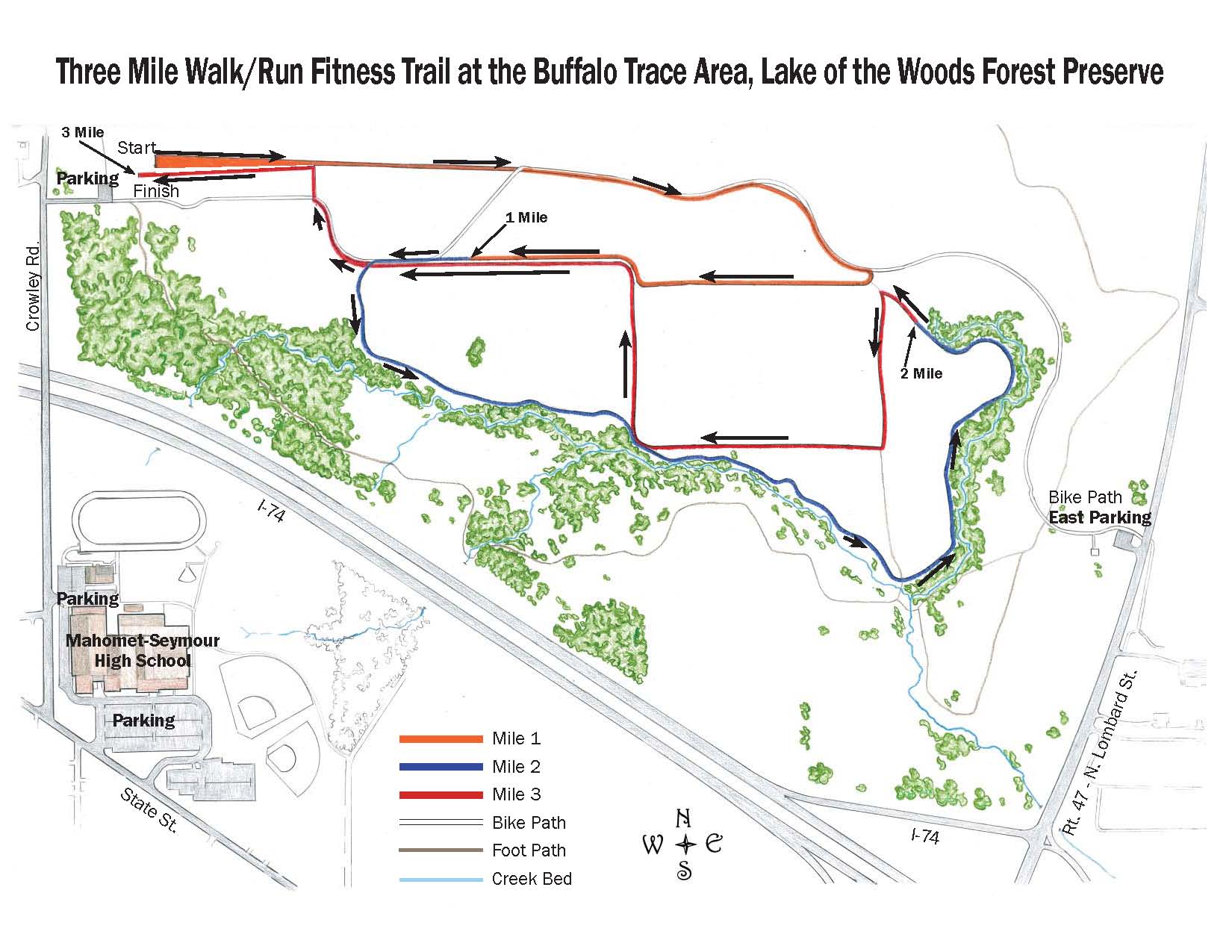
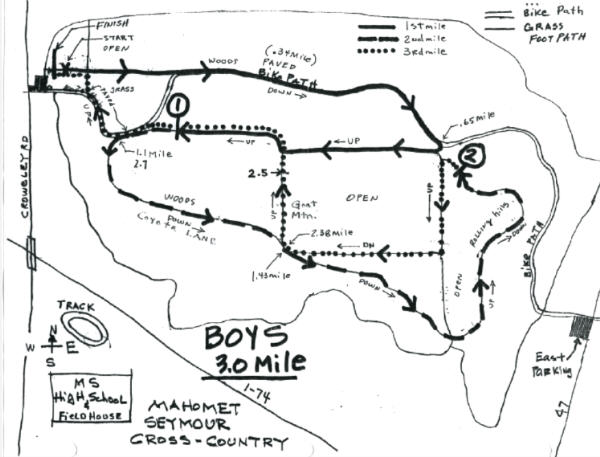
 Mahomet-Seymour
High School Cross Country Course Map
Mahomet-Seymour
High School Cross Country Course Map
The
Mahomet-Seymour high school cross country course is located approximately
1/4 of a mile North of the high school. To get to the course from the
high school, take Crowley Road North over the overpass.
DIRECTIONS: FROM THE SOUTH
Take Route 47 exit off of I-72 to Route 150 (1st stoplight). Cross Route
150 North until you get to the 2nd stop sign. At this stop sign turn
left on State Street. Continue on State Street until you get to next
top sign. At this stop sign, turn right (North) on Crowley Road.
Go past the high school over I-74 and course will be on your right. You
may need to park at the school since there is limited parking at the course.
DIRECTIONS: FROM EAST or WEST
Take I-74 to the Route 47 exit south. Go to 1st stoplight and turn
right on Franklin Street . Continue on Franklin Street as it veers to the
right. Turn left on State Street. You will go past Lincoln
Trail elementary on your right, the Jr. High will be on your left, go past
the high school to the 1st stop sign. Turn right on Crowley Road go
over I-74 and the course will be on your right. You may need to park at
the high school since there is limited parking at the course.
A special thanks
to Jeff Riddle for making this map and doing such a great job maintaining
our high school course.